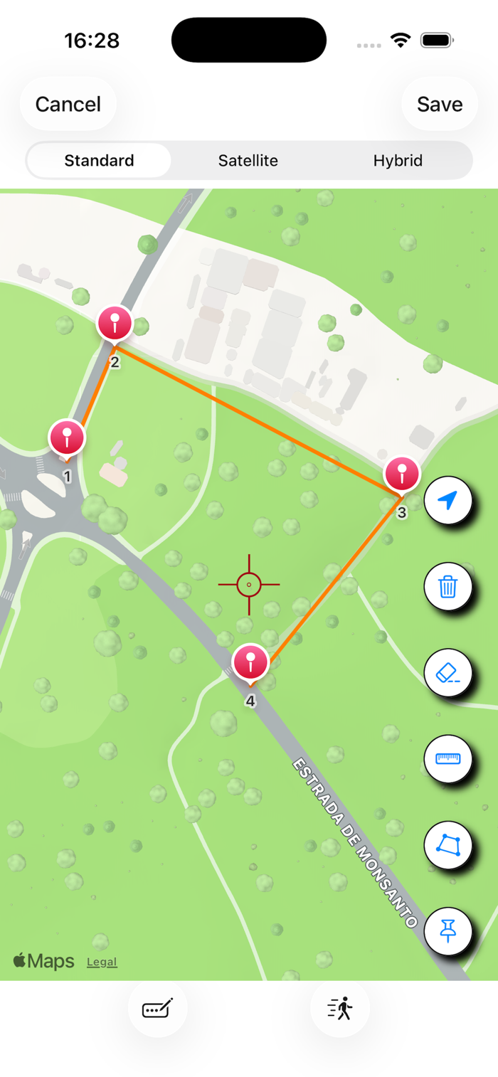
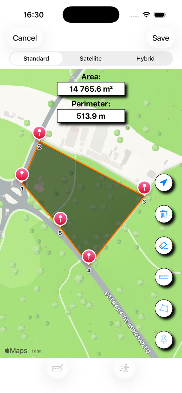
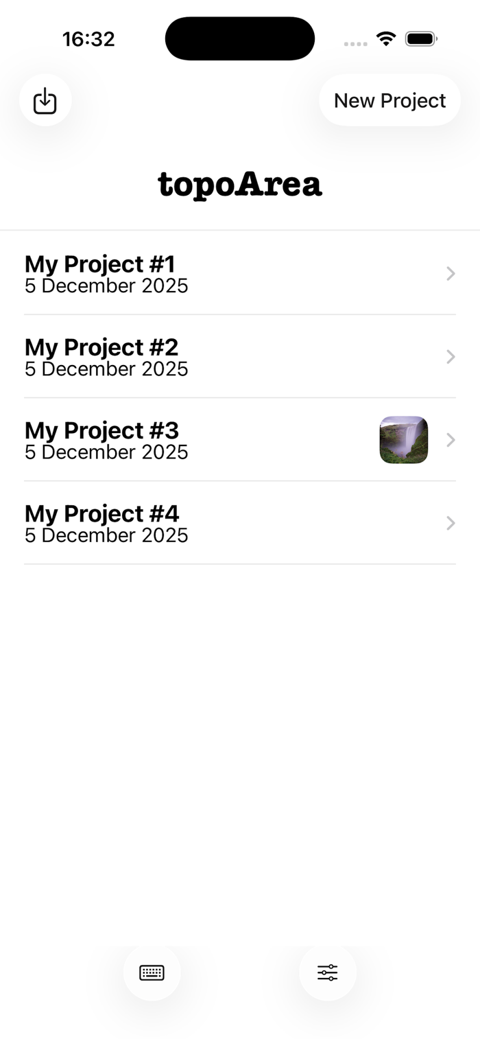
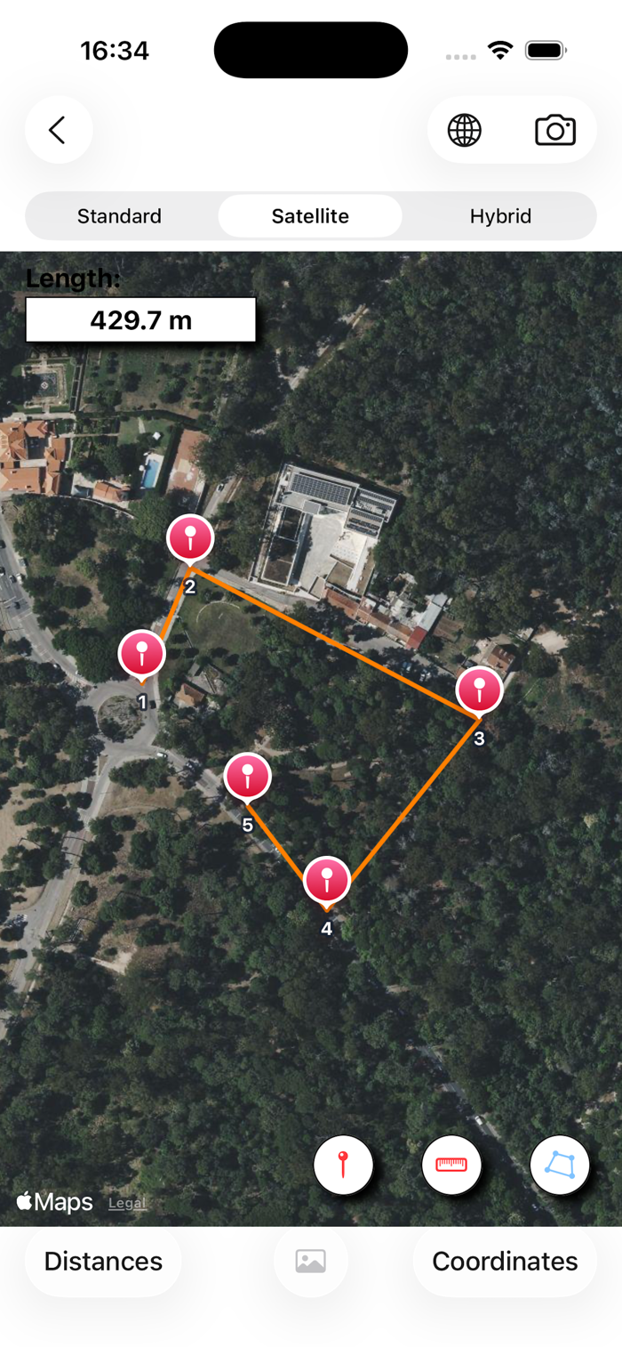
topoArea is an app for measuring areas and lengths through coordinated points on the map.
To do this, simply select different points on the map and then calculate the area and perimeter, or the total length between points.
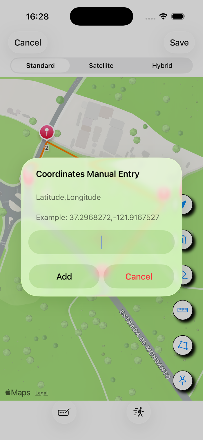
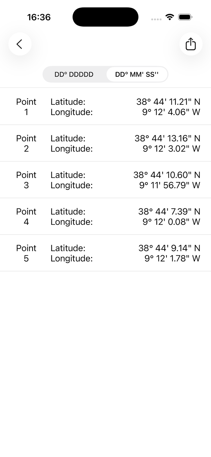
To select the points, a simple click is required, or you can enter the coordinates manually.
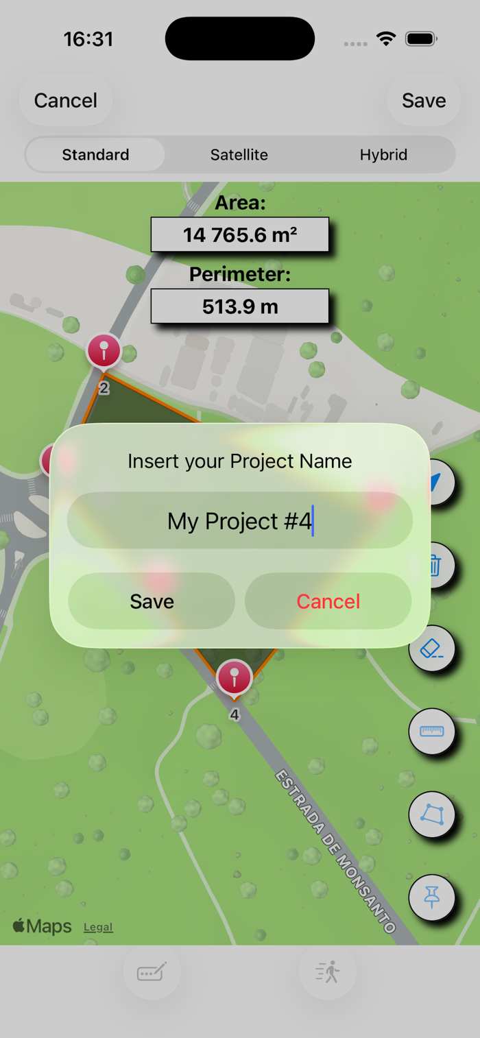
topoArea allows you to export, in "csv" format, the file with the Coordinates, being able to save it in the Files folder, or share it by e-mail or written message, allowing someone else who has the app to import the file and open it. You can also, for example, create the file on the iPhone, export it, and open it on the iPad. Since the file has a "csv" format, it is compatible with Numbers and Excel.
topoArea also allows you to export and share files in the "kml" format, used by Google Earth.
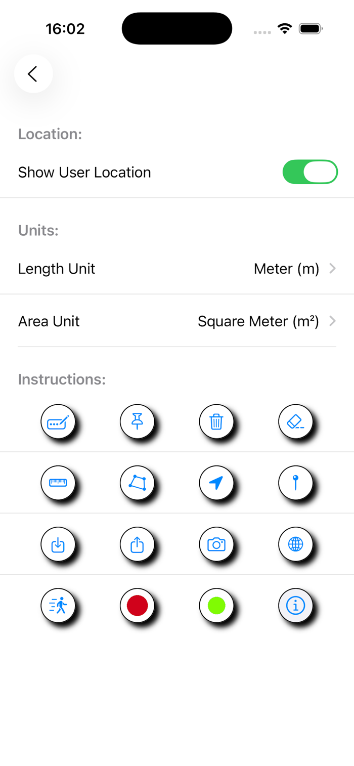
In addition, topoArea has a Coordinate Converter, which allows you to convert between Decimal Degrees, Degrees Minutes and Seconds, and UTM using WGS84.
Features:
- Measurement of areas, perimeters and lengths;
- Introduction of Coordinates by fixing the point, or manually, by latitude and longitude in decimal degrees;
- Export, in "csv" format, of coordinates and distances;
- Export, in "jpg" format, of the screen image
- Import, in "csv" format, of Coordinates, in the topoArea model;
- Export, in "kml" format, of Points, Lines and Polygons;
- Units in the metric system or in the imperial system;
- Coordinate Converter.

 +100宝石


 分享
分享


用户评价
立即分享产品体验
你的真实体验,为其他用户提供宝贵参考
💎 分享获得宝石
【分享体验 · 获得宝石 · 增加抽奖机会】
将你的产品体验分享给更多人,获得更多宝石奖励!
💎 宝石奖励
每当有用户点击你分享的体验链接并点赞"对我有用",你将获得:
🔗 如何分享
复制下方专属链接,分享到社交媒体、群聊或好友:
💡 小贴士
分享时可以添加你的个人推荐语,让更多人了解这款产品的优点!
示例分享文案:
"推荐一款我最近体验过的应用,界面设计很精美,功能也很实用。有兴趣的朋友可以看看我的详细体验评价~"
领取结果