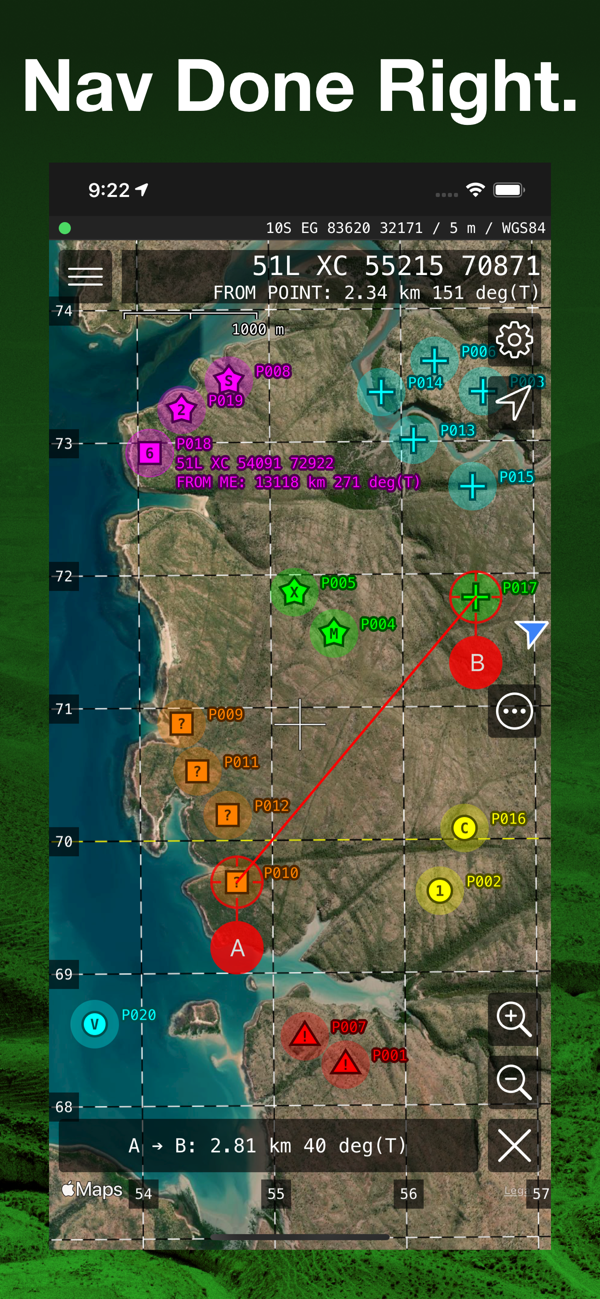
MilGPS is an MGRS/USNG focused premium navigation tool trusted by soldiers, search and rescue personnel and other professional navigators around the world. View your current location and navigate to a waypoint in seconds. Or plan and organize your navigation using the powerful and intuitive mapping and overlay capabilities.
No in-app purchases or subscriptions.
FEATURES
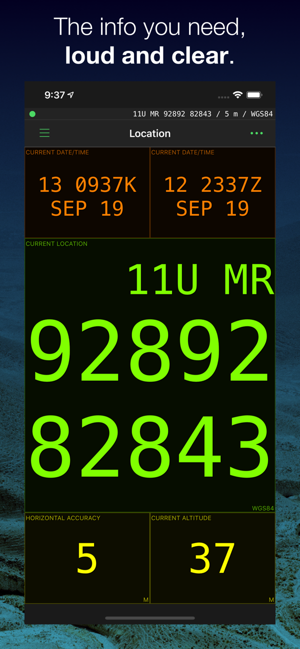
Display your current location in real time
- Cell phone signal not required but will make location fixes faster (maps require a data connection)
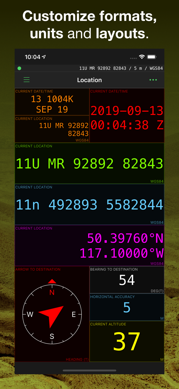
- Military Grid Reference System (MGRS) & United States National Grid (USNG) (4, 6 8 10 figure grid references supported)
- Universal Transverse Mercator (UTM)
- Latitude/Longitude (degrees, degrees and minutes, degrees minutes seconds supported)
- Ordnance Survey National Grid (grid and easting/northing in metres)
- Military date time groups for local/zulu time
- All info is displayed in large, clear text for easy viewing at all times
- Location and navigate screens are fully customisable - choose what info you want to see
- Wide variety of datums supported including WGS84, NAD27, OSGB36, AGD66, ED50
- Define up to 3 combinations of datum and location format for location display and waypoint entry
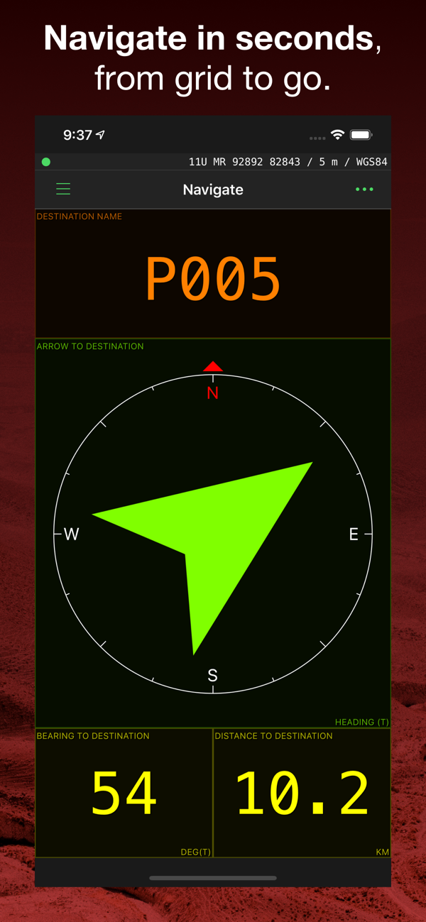
Create and navigate to waypoints
- Unlimited waypoints (upper limit dependent on device storage and memory)
- Enter waypoints from current location, map or using any of the above supported ...

 +100宝石


 分享
分享