
 +100宝石

加入 Mergeek 福利群
扫码添加小助手,精彩福利不错过!
若不方便扫码,请在 Mergeek 公众号,回复 群 即可加入
- 精品限免
- 早鸟优惠
- 众测送码

Canals Saône - River tourism
内河航行导航,提供船闸港口等便利信息
 分享
分享


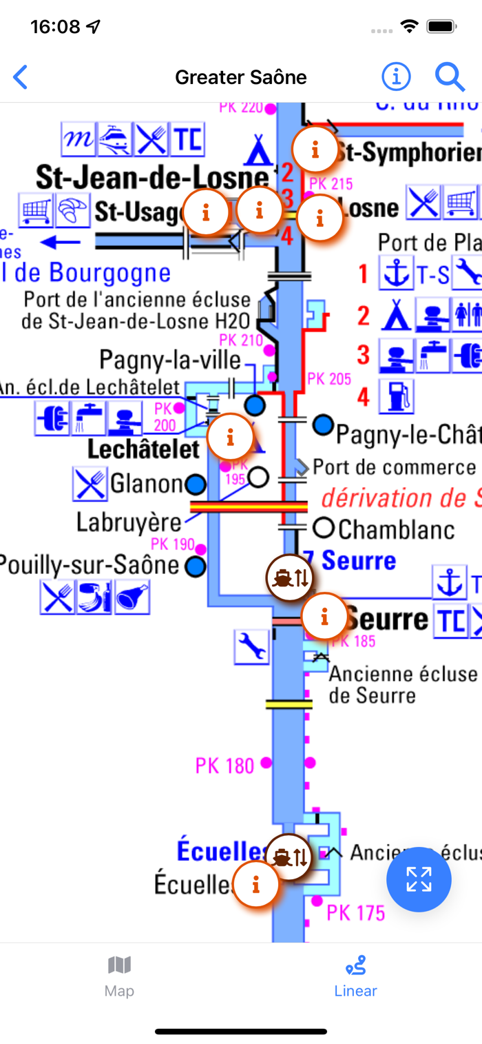

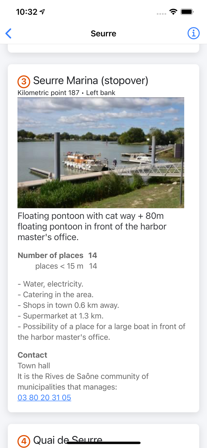


这款产品能让您轻松享受法国运河之旅,摆脱繁琐的停泊地点罗列任务。它配备专为内河航行设计的高质量显示屏,可呈现地理地图与带地理位置的线路示意图,助您轻松定位船闸、港口等。还能查看路线上各地点现有航海停靠点列表及详细地图与照片,了解停靠点的图片描述、设施信息等,并有联系表单,为您的运河航行提供便利全面的导航指引。


用户评价
立即分享产品体验
你的真实体验,为其他用户提供宝贵参考
💎 分享获得宝石
【分享体验 · 获得宝石 · 增加抽奖机会】
将你的产品体验分享给更多人,获得更多宝石奖励!
💎 宝石奖励
每当有用户点击你分享的体验链接并点赞"对我有用",你将获得:
🔗 如何分享
复制下方专属链接,分享到社交媒体、群聊或好友:
💡 小贴士
分享时可以添加你的个人推荐语,让更多人了解这款产品的优点!
示例分享文案:
"推荐一款我最近体验过的应用,界面设计很精美,功能也很实用。有兴趣的朋友可以看看我的详细体验评价~"