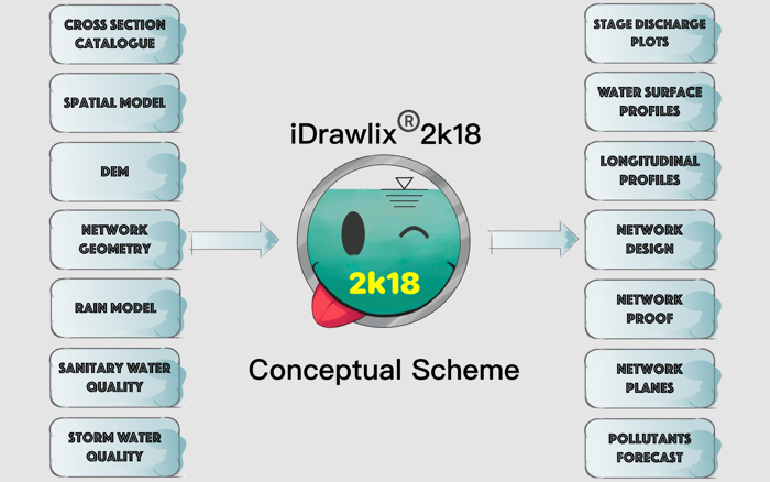
MODEL:
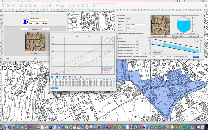
The Sewer Network Model is based on Manhole collections. Conduits are linear elements which connect Manholes. Pumps, Inflows and CSOs are considered as special Manholes. Drainage Areas are modeled as geometric surfaces connected to the downstream Manholes of each Conduit. Users can interactively define the Network Longitudinal Layout, fine tuning Crowns, Inverts and Slopes.
Spatial Model: through Georeferenced Bitmaps and World files.
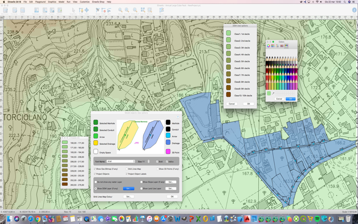
Digital Elevation Model: iDrawlix® 2k18 can build the Spatial Model DEM, starting from a set of 3D Points or importing it directly in the ARC/INFO ASCII GRID file format. Starting from the DEM, iDrawlix® 2k18 can build the Slope spatial distribution.
iDrawlix® 2k18 can build and handle Land Use Maps in order to define and describe the spatial distribution of the Runoff coefficients. Import/Export in the ARC/INFO ASCII GRID file format is fully supported.
Rain Model: iDrawlix® 2k18 provides a variety of method to choose the Intensity Duration Frequencies (IDFs): 2 parameters, hyperbolic 3 parameters, ASCE 3 parameters and directly the precipitations of the Deutscher Wetterdienst. Users are allowed to set the desired Return Period in order to test the Sewer Network.
Sanitary Model: Sanitary Unit Loads are model-defined through key-forecasting parameters derived from prestigious academic literature. For each Drainage Area, Users are allowed to specify single load sources (example: inhabitants per housing, pupi...

 +100宝石


 分享
分享


用户评价
立即分享产品体验
你的真实体验,为其他用户提供宝贵参考
💎 分享获得宝石
【分享体验 · 获得宝石 · 增加抽奖机会】
将你的产品体验分享给更多人,获得更多宝石奖励!
💎 宝石奖励
每当有用户点击你分享的体验链接并点赞"对我有用",你将获得:
🔗 如何分享
复制下方专属链接,分享到社交媒体、群聊或好友:
💡 小贴士
分享时可以添加你的个人推荐语,让更多人了解这款产品的优点!
示例分享文案:
"推荐一款我最近体验过的应用,界面设计很精美,功能也很实用。有兴趣的朋友可以看看我的详细体验评价~"
领取结果