
 +100宝石

加入 Mergeek 福利群
扫码添加小助手,精彩福利不错过!
若不方便扫码,请在 Mergeek 公众号,回复 群 即可加入
- 精品限免
- 早鸟优惠
- 众测送码

AxisTrack: Survey & GIS Tool
GPS测量与GIS应用,含多工具及高级分析功能
 分享
分享


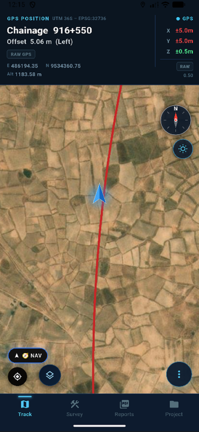
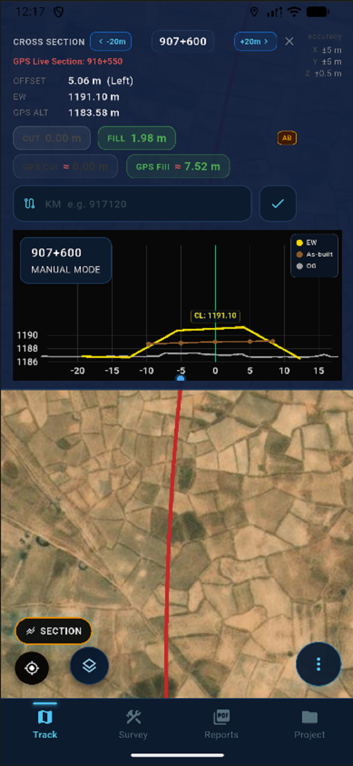
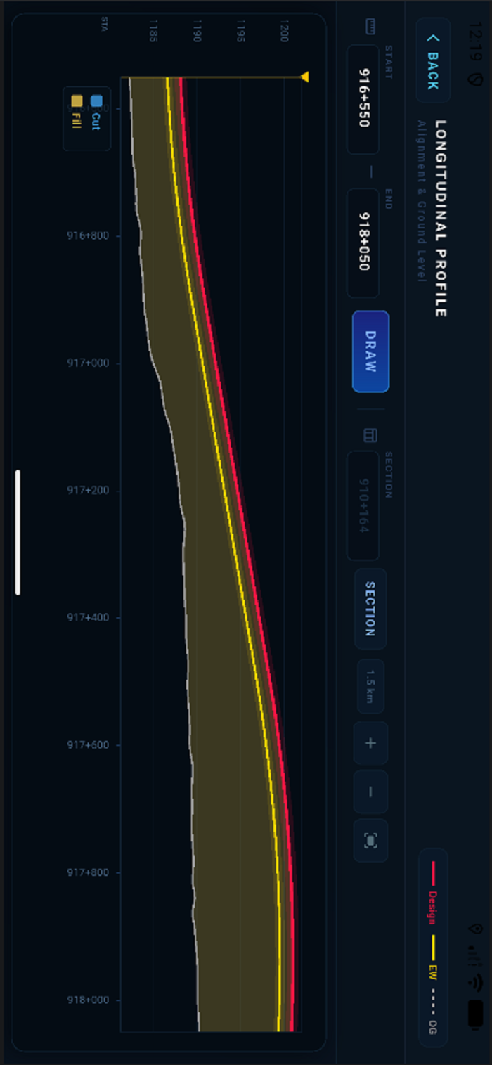
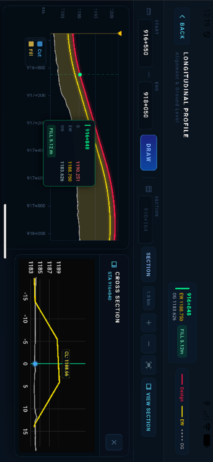
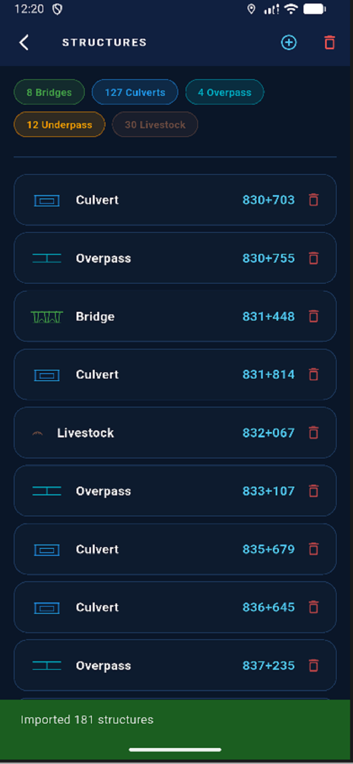
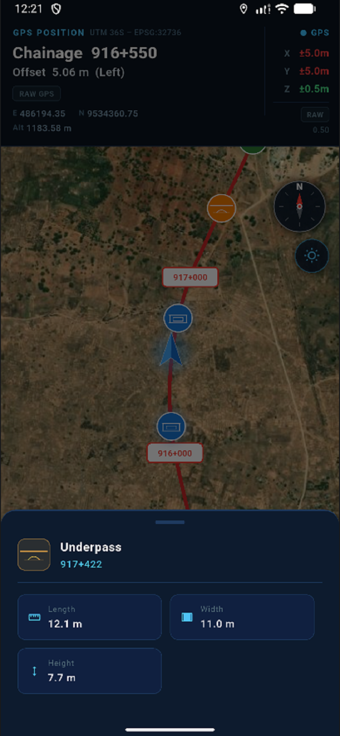


AxisTrack是一款面向土木工程师、施工团队和野外测量员的专业GPS测量与GIS应用程序。具备实时定位、路线跟踪及高级土方分析工具,可现场作业。核心功能包括:实时GPS定位与链距及偏移跟踪;道路、铁路等项目的路线导航;横断面与纵断面分析;土方工程的挖填方计算;导入LandXML;提供离线卫星地图;管理结构物;现场数据采集及基于照片的报告;支持PDF导出用于专业现场文档。能助力工程师减少误差、提高精度并快速决策,还有无限项目等高级功能。


用户评价
立即分享产品体验
你的真实体验,为其他用户提供宝贵参考
💎 分享获得宝石
【分享体验 · 获得宝石 · 增加抽奖机会】
将你的产品体验分享给更多人,获得更多宝石奖励!
💎 宝石奖励
每当有用户点击你分享的体验链接并点赞"对我有用",你将获得:
🔗 如何分享
复制下方专属链接,分享到社交媒体、群聊或好友:
💡 小贴士
分享时可以添加你的个人推荐语,让更多人了解这款产品的优点!
示例分享文案:
"推荐一款我最近体验过的应用,界面设计很精美,功能也很实用。有兴趣的朋友可以看看我的详细体验评价~"
领取结果