Trusted by GIS professionals for field data collection. Mapit GIS brings professional-grade spatial data capture to iPhone and iPad, designed for surveyors, environmental consultants, foresters, and anyone who works with spatial data in the field.
Download for free and start mapping immediately. Optional paid subscriptions unlock additional features as described below.
FREE FEATURES (included with download, no purchase required):
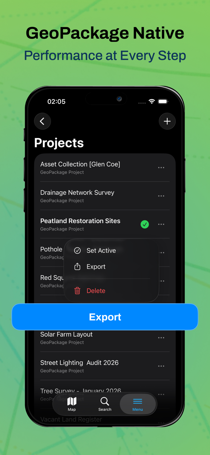
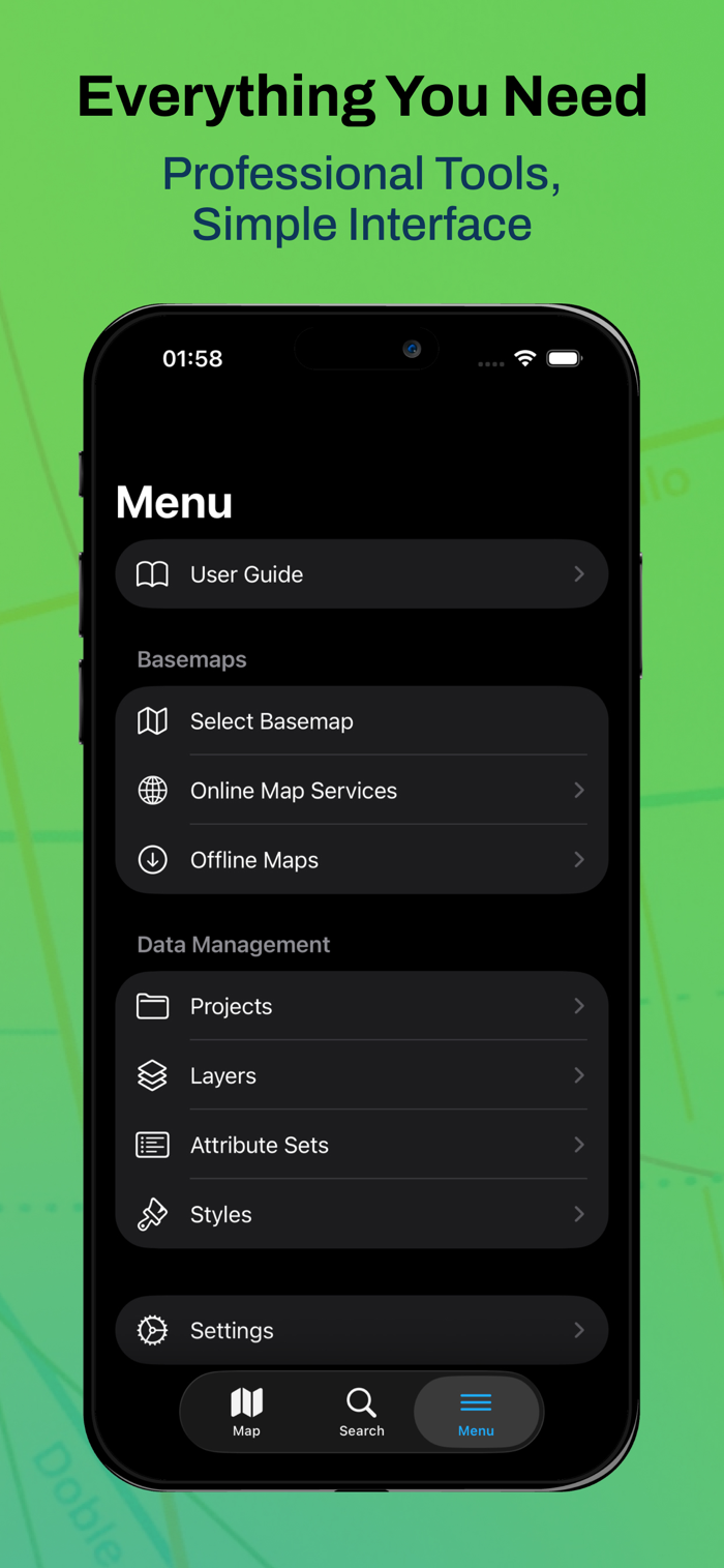
- GeoPackage Native: Manage your data through GeoPackage projects (.gpkg) for seamless data sharing with desktop GIS applications like QGIS or ArcGIS.
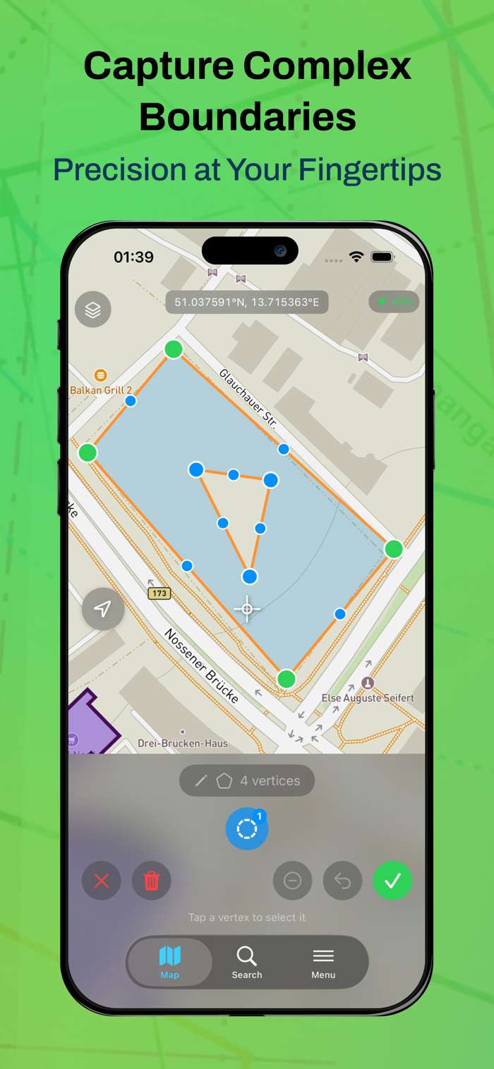
- Capture Points, Lines, and Polygons
- Create vector features directly on the map using GPS or manual placement
- Support for complex multi-part geometries. Free tier includes 1 project
- 3 layers, and 20 features per layer.
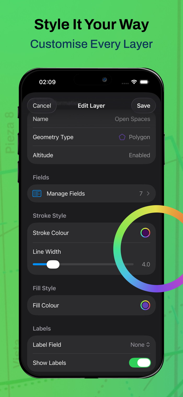
- Custom Attributes with Forms
Design data collection forms with dropdowns, multi-select lists, dates, and barcode scanners.
Customise your workflow for each project.
- GeoJSON Export and Import
Export and import data in GeoJSON format.
- Professional Styling
Customise feature colours, sizes, and labels. Apply styles based on the attribute values.
PRO SUBSCRIPTION FEATURES (paid subscription):
Available as an auto-renewable subscription (see price in your local currency):
- Unlimited Projects, Layers, and Features
Remove all limits on projects, layers, and features per layer.
- Full Format Export and Import
Export and import in Shapefile, KML, GPX, CSV, and DXF formats in addition to
GeoJSON.
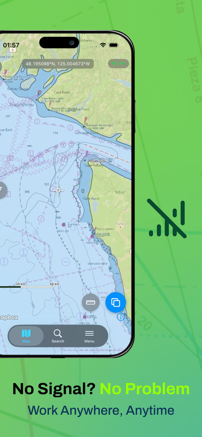
- Offline Maps
Add MBTiles offline basemaps for fieldwork in areas without connectivity.
- Online Map Services
Connect to WMS, WFS, WMTS, and XYZ tile services for custom basemaps and reference layers.
- GPS Track Recording
Automatically capture vertices while walking for line and polygon surveys.
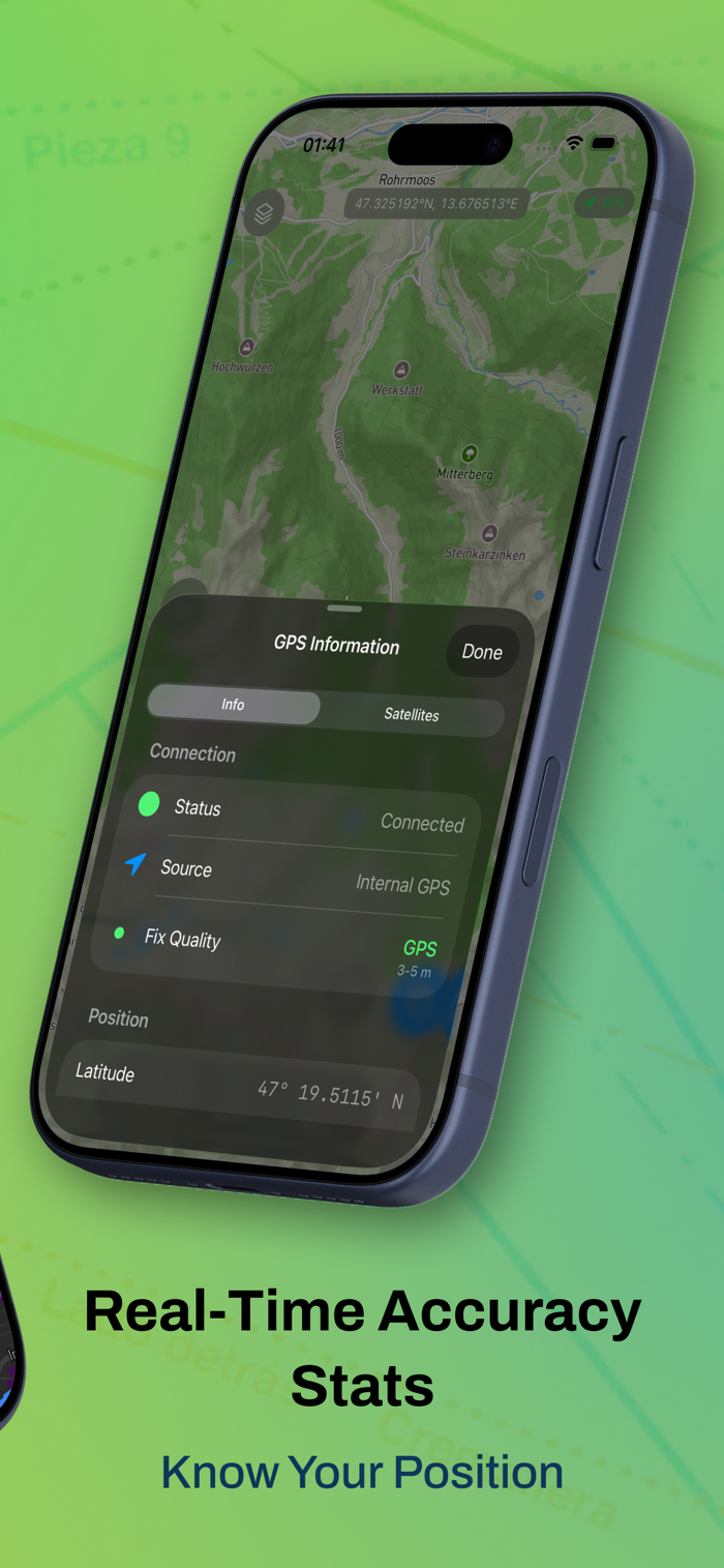
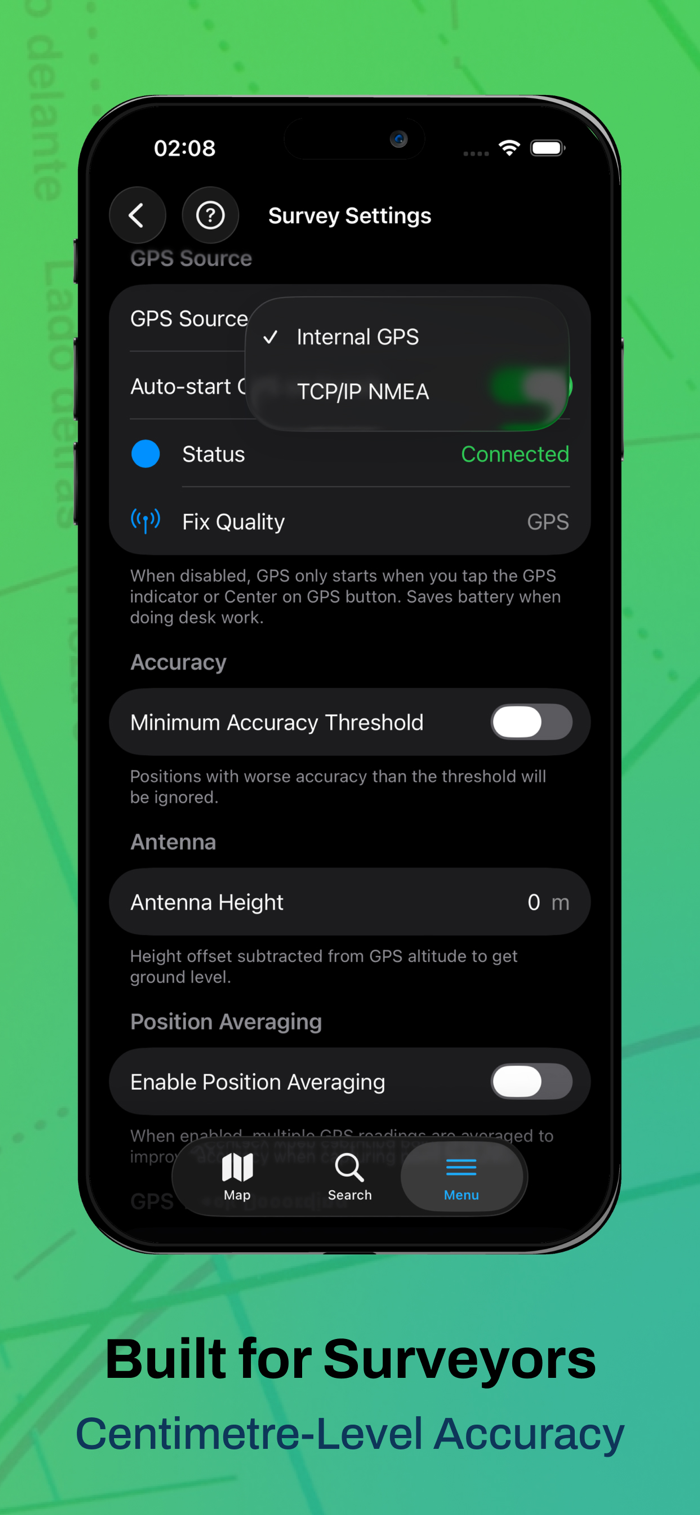
- External GNSS Receivers
Connect to external GNSS receivers via TCP/IP or Bluetooth LE for high-precision positioning. View HDOP, VDOP, PDOP, fix type, and satellite constellation data. Compatible with RTK-corrected coordinate streams.
Bluetooth Classic is currently supported for EOS Positioning (Arrow series) and Juniper Systems devices (Geode, Spire).
- Position Averaging
Improve point accuracy by averaging multiple GPS readings for survey-grade results.
- Feature and Place Search
Search within your GeoPackage data and find places on the map.
PRO+ SUBSCRIPTION FEATURES (paid subscription):
Pro+ includes all Pro features plus the following. Available as an
auto-renewable subscription (see price in your local currency):
- NTRIP RTK Corrections
Connect to NTRIP casters to receive real-time RTK corrections for centimetre-accurate positioning. Browse and select mountpoints sorted by distance, monitor RTCM data streams, and send GGA position feedback. RTCM corrections are forwarded to your connected GNSS receiver via TCP or Bluetooth LE. Compatible with services such as rtk2go.com and commercial NTRIP providers.
IDEAL FOR:
- Environmental Surveys & Ecology
- Forestry Planning & Woodland Management
- Agriculture & Soil Surveys
- Land Surveying & Site Surveys
- Tree Surveys & Arboriculture
- Construction & Infrastructure
- Utilities & Asset Management
SUBSCRIPTION INFORMATION:
Mapit GIS Pro and Pro+ are available as monthly or annual auto-renewable subscriptions. Prices are displayed in your local currency on the subscription page. Pro subscribers can upgrade to Pro+ at any time with prorated pricing. Payment is charged to your Apple ID account at confirmation of purchase. Subscriptions automatically renew unless cancelled at least 24 hours before the end of the current period. You can manage and cancel subscriptions in your Apple ID account settings.
Terms of Use: https://mapitgis.com/terms
Privacy Policy: https://mapitgis.com/privacy-policy

 +100宝石


 分享
分享


用户评价
立即分享产品体验
你的真实体验,为其他用户提供宝贵参考
💎 分享获得宝石
【分享体验 · 获得宝石 · 增加抽奖机会】
将你的产品体验分享给更多人,获得更多宝石奖励!
💎 宝石奖励
每当有用户点击你分享的体验链接并点赞"对我有用",你将获得:
🔗 如何分享
复制下方专属链接,分享到社交媒体、群聊或好友:
💡 小贴士
分享时可以添加你的个人推荐语,让更多人了解这款产品的优点!
示例分享文案:
"推荐一款我最近体验过的应用,界面设计很精美,功能也很实用。有兴趣的朋友可以看看我的详细体验评价~"
关注 Mergeek 公众号
领奖遇到问题?联系小门助手