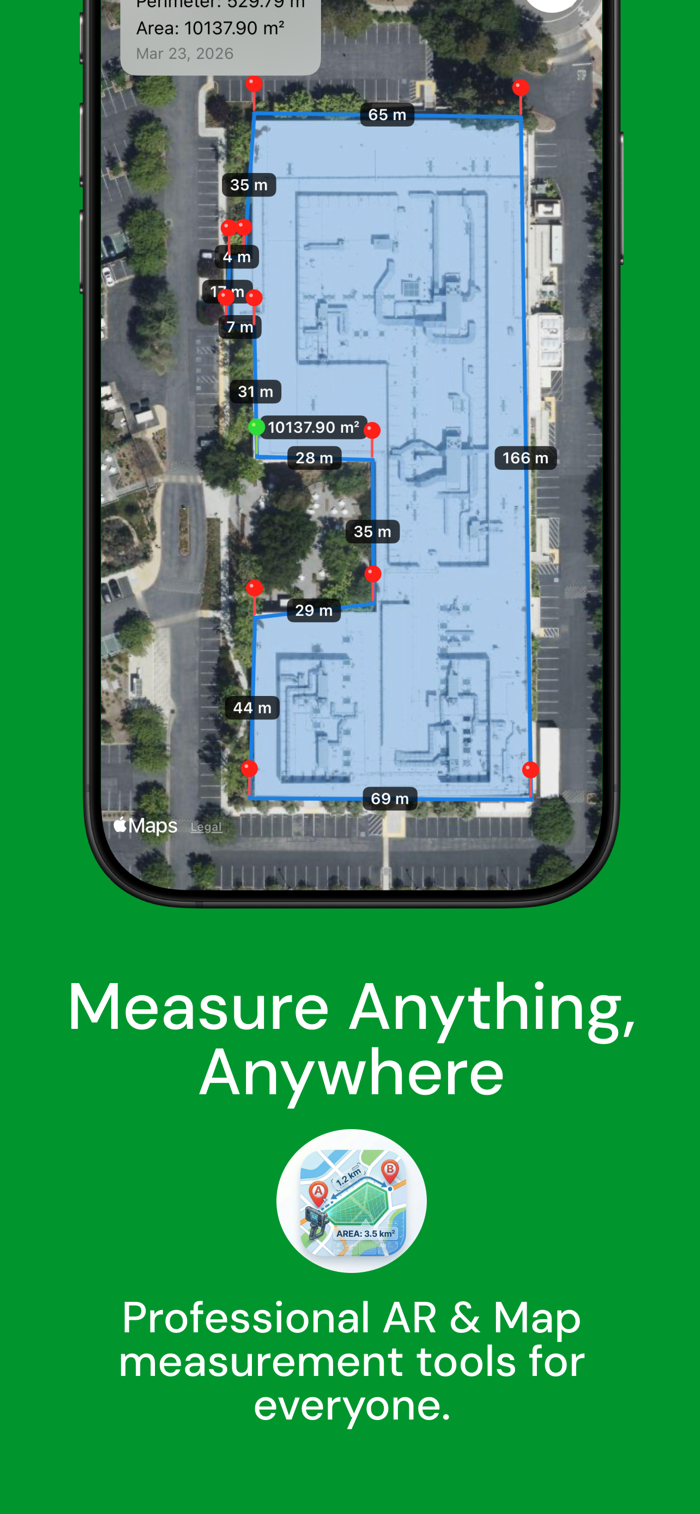
GeoMeasure - GPS & AR Measurement Toolkit
GeoMeasure is the ultimate professional tool for accurate measurement of areas, distances, volumes, and perimeters. Whether you are a land surveyor, a farmer measuring crops, an outdoor enthusiast, or simply someone measuring room dimensions at home, GeoMeasure provides high-precision results with a sleek, intuitive interface through both GPS Maps and Augmented Reality (AR).
Key Features:
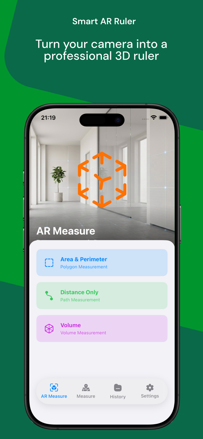
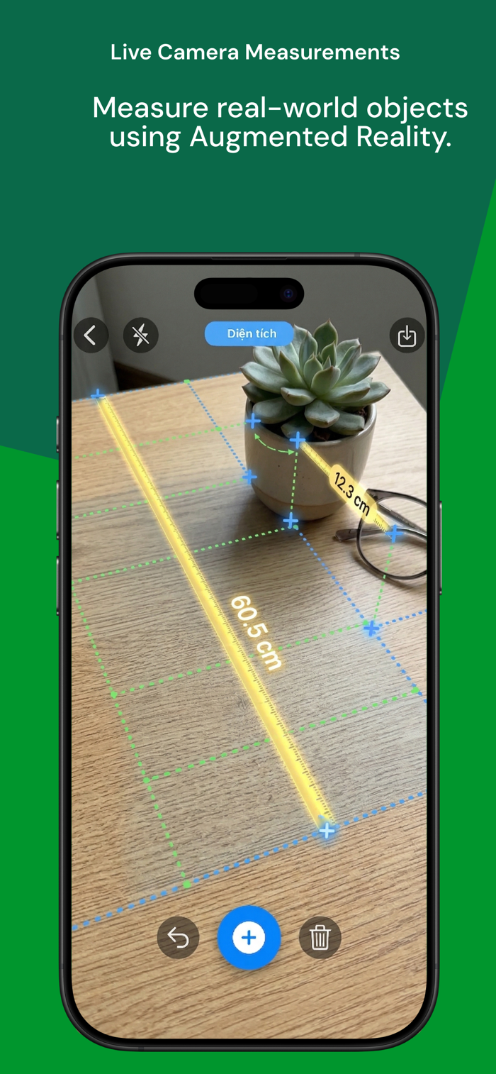
- Powerful AR Measurement (New): Transform your device into a virtual tape measure! Instantly measure straight distances, 2D floor areas, or even extract full 3D volumes (prisms) using cutting-edge ARKit technology.
- Save AR Snapshots: Seamlessly save your AR measurements with stunning 3D wireframes and metric labels right into your history.
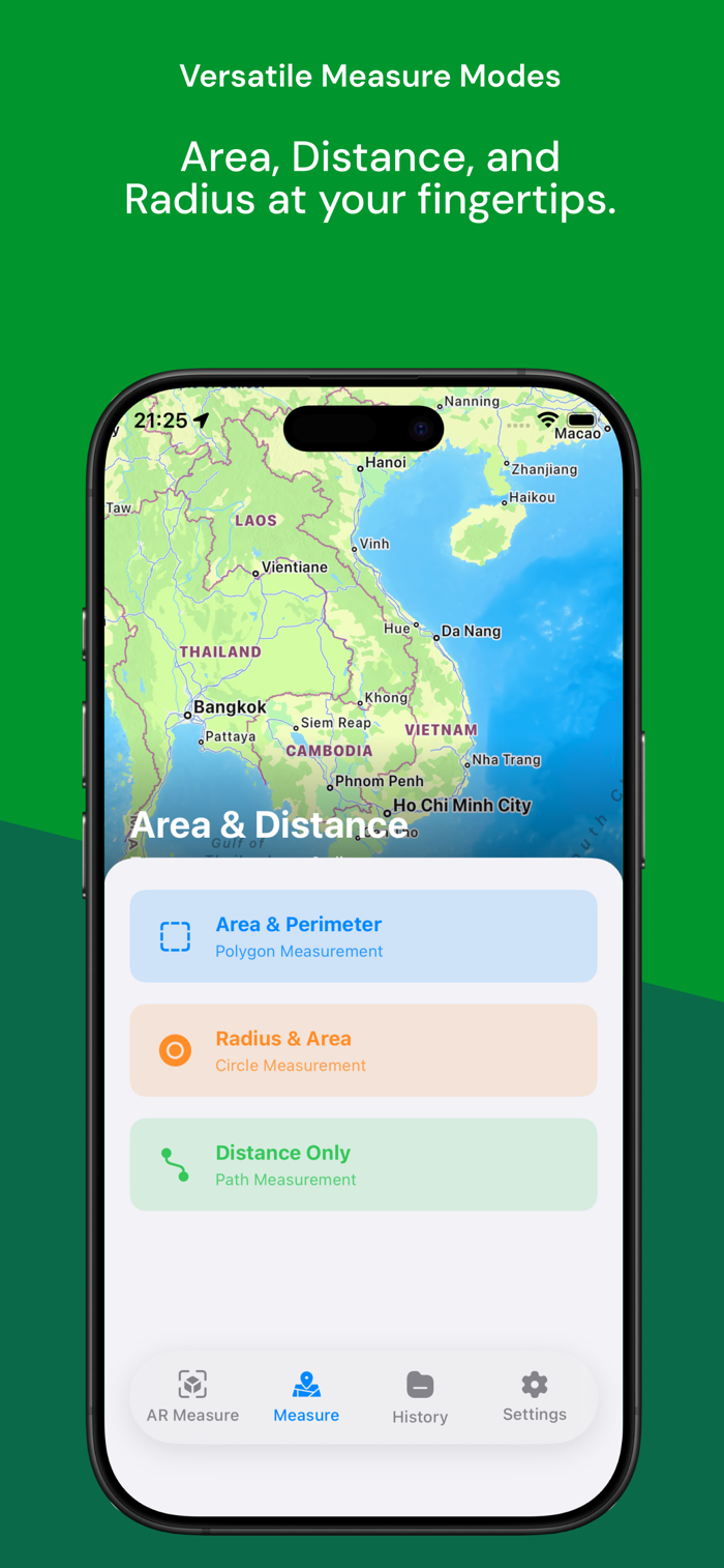
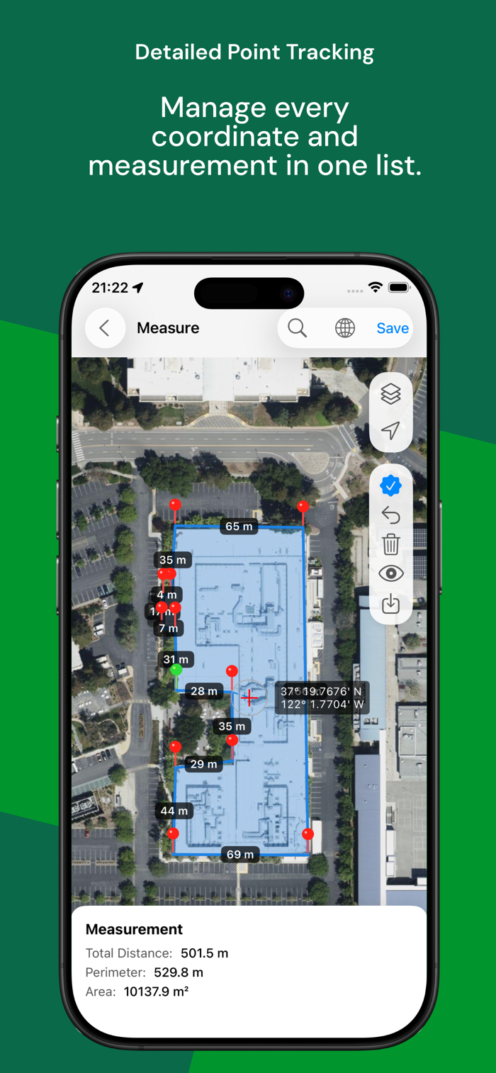
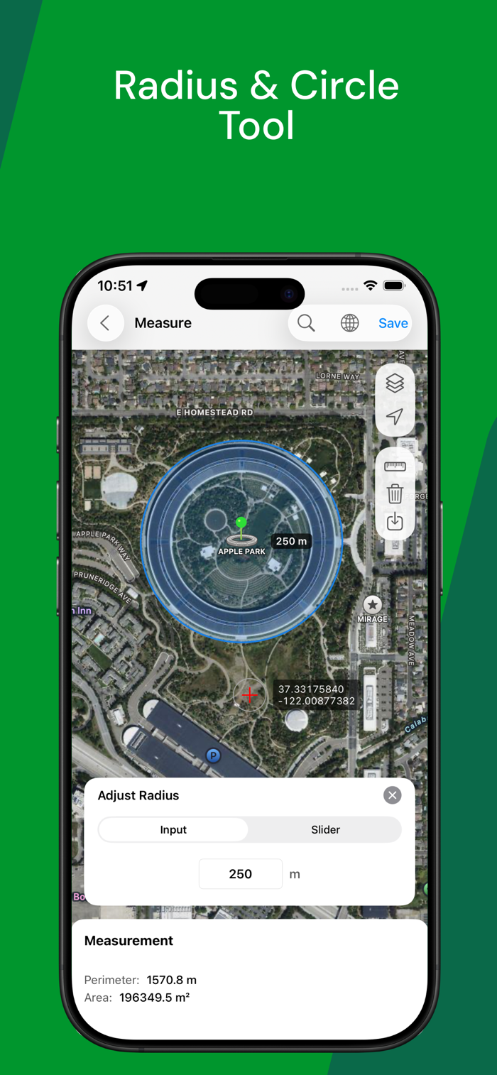
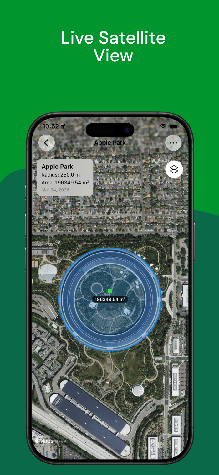
- Multiple Map Modes: Accurately measure map areas and perimeters via Polygon, calculate radius with Circle mode, or track distance along a specific Path.
- High Precision: Built on advanced MapKit and ARKit technology to ensure professional-grade accuracy in both giant fields and tight interior spaces.
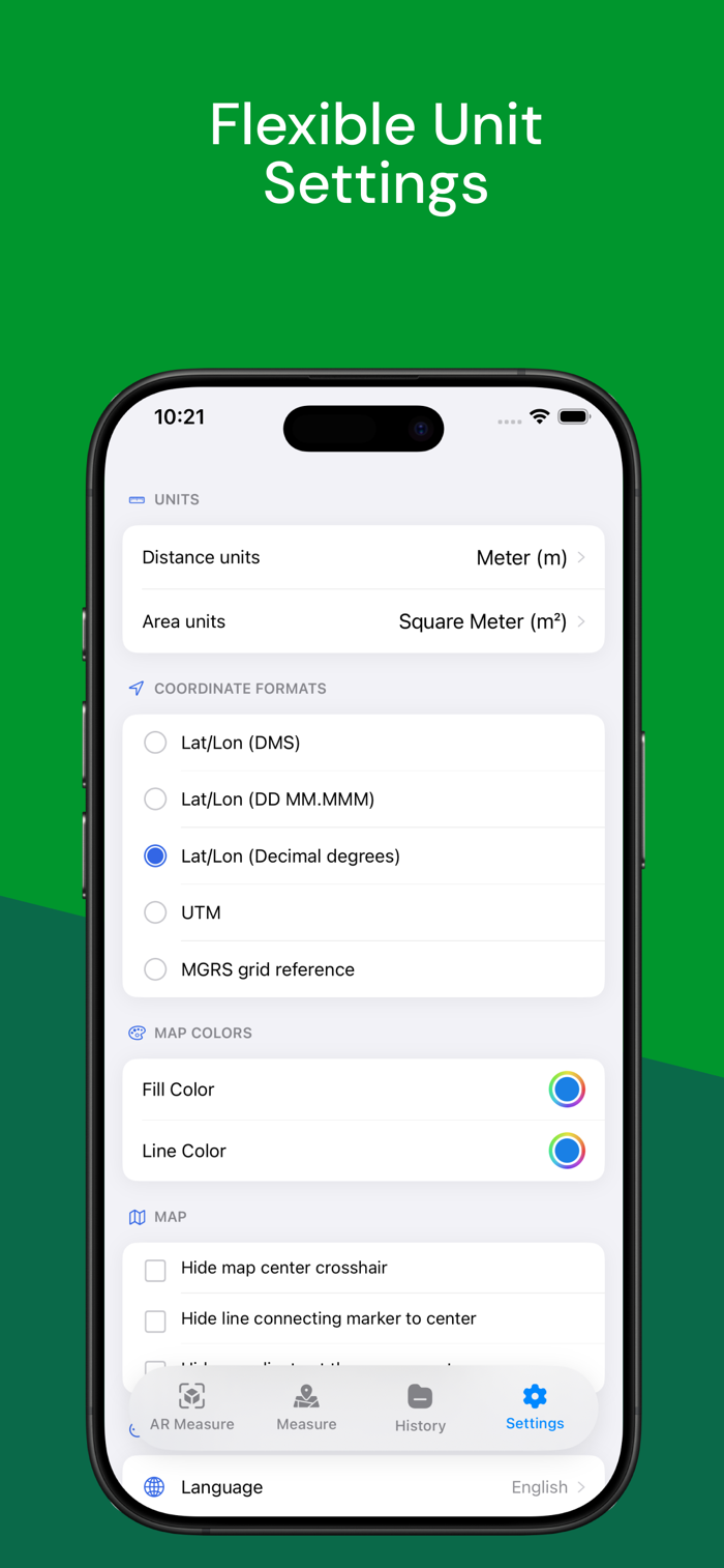
- Flexible Units: Quickly switch between Metric (m, km, ha, m², m³) and Imperial (ft, yd, mile, acre, sq ft) units. Smart formatting ensures small measurements automatically adapt to cm or cm³.
- Professional Export: Keep all your sessions beautifully organized in History (segmented by Map and AR). Save and export your measurements to PDF for reports and sharing.
- Glo...

 +100宝石


 分享
分享


用户评价
立即分享产品体验
你的真实体验,为其他用户提供宝贵参考
💎 分享获得宝石
【分享体验 · 获得宝石 · 增加抽奖机会】
将你的产品体验分享给更多人,获得更多宝石奖励!
💎 宝石奖励
每当有用户点击你分享的体验链接并点赞"对我有用",你将获得:
🔗 如何分享
复制下方专属链接,分享到社交媒体、群聊或好友:
💡 小贴士
分享时可以添加你的个人推荐语,让更多人了解这款产品的优点!
示例分享文案:
"推荐一款我最近体验过的应用,界面设计很精美,功能也很实用。有兴趣的朋友可以看看我的详细体验评价~"
领取结果