产品功能

应用市场介绍

The 
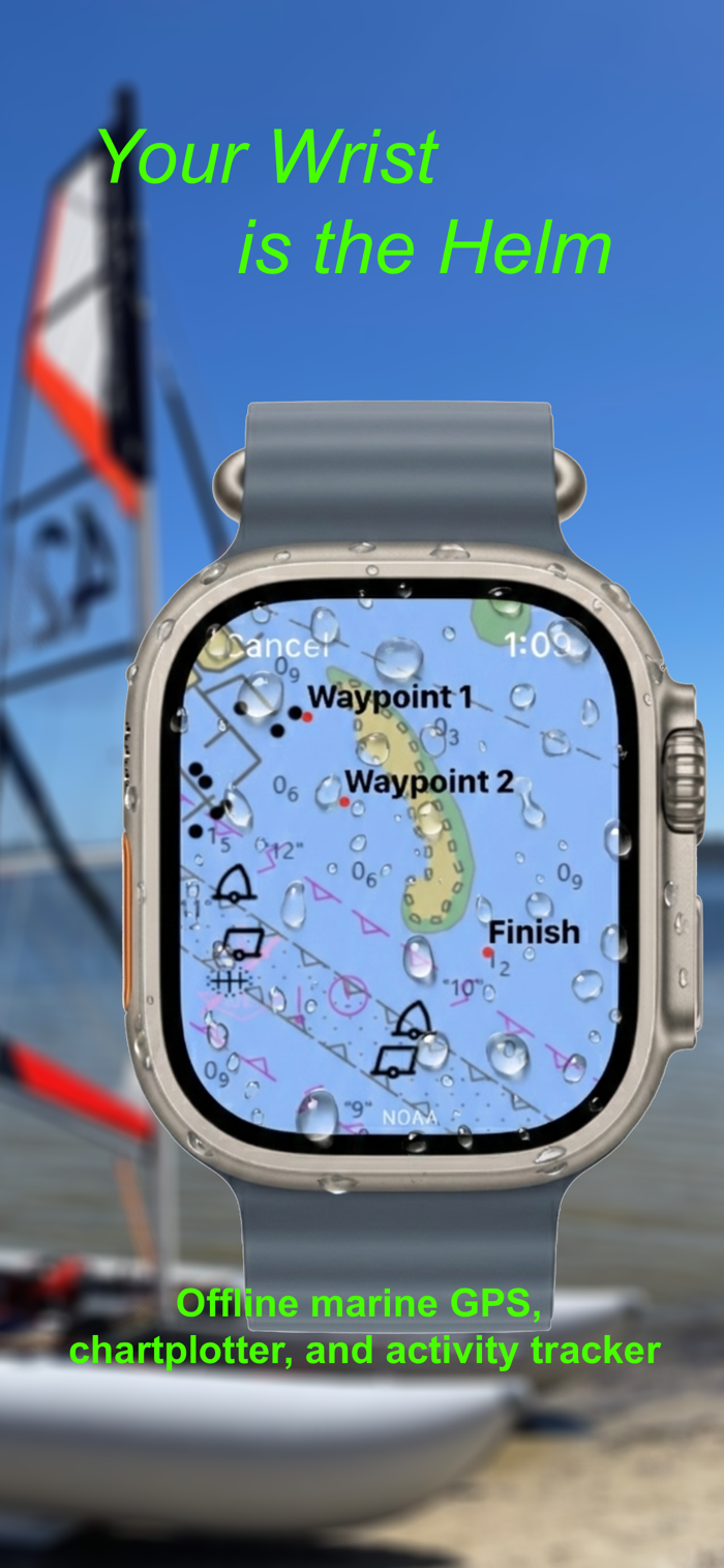
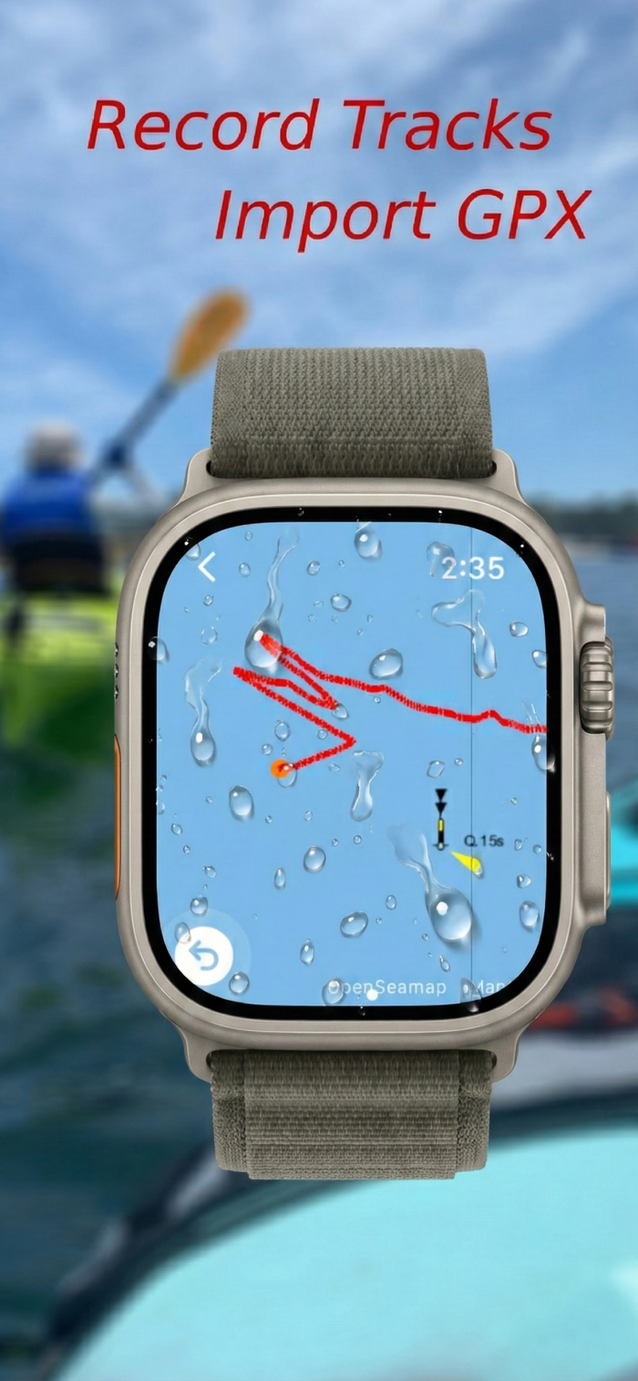
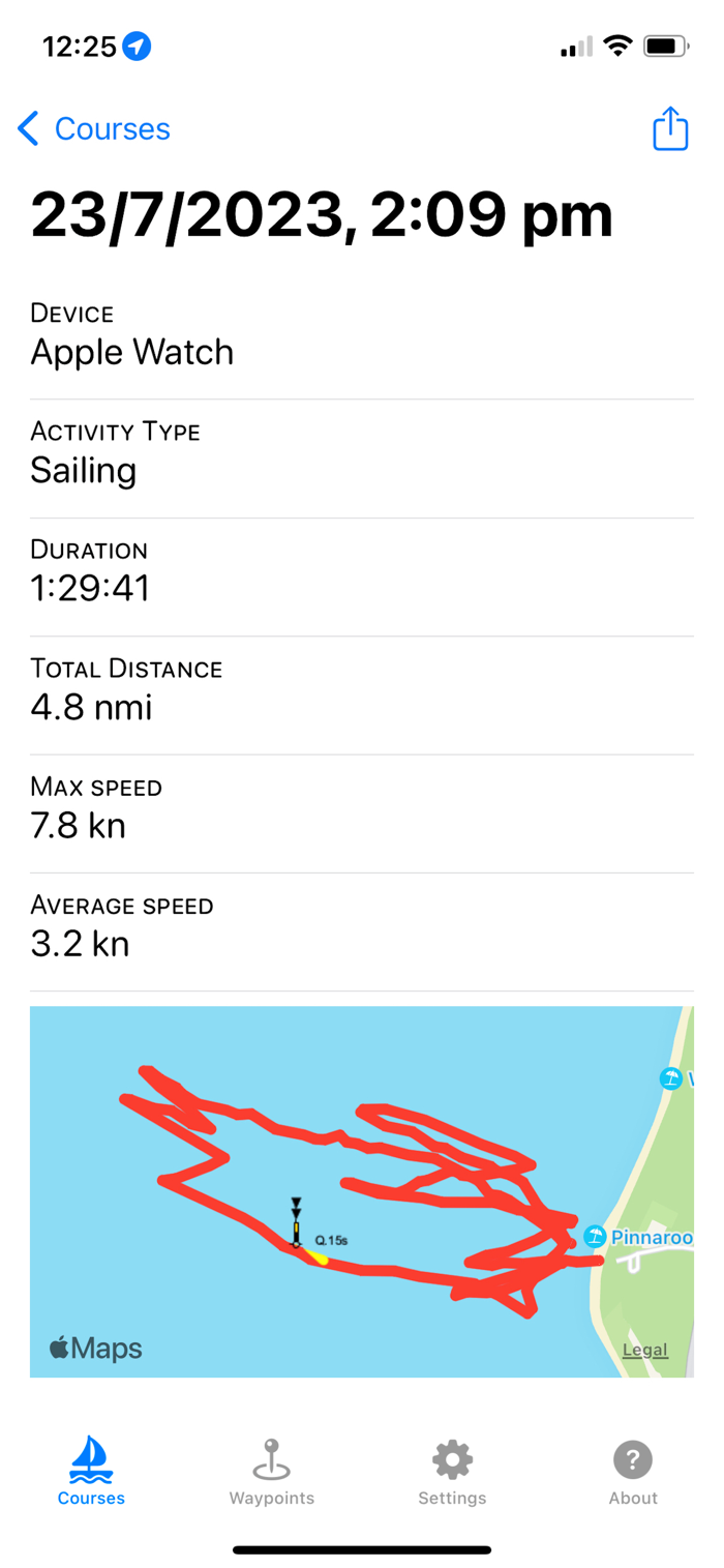
Performance Marine GPS for Racing & Sailing
Transform your Apple Watch into a powerful, tactical racing computer. Watch Chartplotter is designed for competitive sailors, windsurfers, and kite racers who demand real-time performance data right on their wrist. Leave the bulky electronics behind and get the critical metrics you need to sail faster and smarter.
Optimize Your Performance with VMG
Make better tactical decisions with live Velocity Made Good (VMG). See exactly how fast you are closing in on your next waypoint and adjust your heading to maximize your efficiency toward the mark.
Essential Racing Metrics on Your Wrist
Stay informed without losing focus. Get instant, glanceable access to your most vital data:
Real-Time Speed: Track your current boatspeed in knots, mph, or km/h.
Average & Max Speed: Monitor your session's performance and push for a new personal best.
Precise Heading: See your current course and the bearing to your next waypoint.
Distance to Mark: Know exactly how far you have to go.
Seamless Waypoint Navigation
Plan your course on your iPhone and sync it directly to your watch. The app automatically transitions to the next waypoint as you round a mark, with haptic feedback to keep you alerted without needing to look at the screen.
Professional-Grade, Offline Charts
Navigate with confidence using NOAA (U.S.), Australian Hydrographic Office (Australia) and OpenSeaMap (Worldwide) charts. Download offline. Power users can also add custom WMS and XYZ map servers for specialized layers.
Built for the Elements
Water Lock: Prevents accidental screen touches from spray and waves.
HealthKit Integration: Logs your racing sessions as workouts, tracking your route, heart rate, and calories burned.
Pay Once, Race Forever.
Enjoy all professional features with a single purchase. No subscriptions, no hidden fees.
Perfect for dinghy racing, catamaran sailing, kite foiling, and any on-water activity where performance matters. Get the winning edge with Watch Chartplotter.
Note: This app is not certified for navigation. It is not an official navigational chart and must not be used for navigation or any related operational decision-making. It is designed to support shore-based maritime awareness and analysis.
Map and chart data copyright: NOAA, Australian Hydrographic Office, OpenStreetMap, Thunderforest and Mapbox.

收起

用户评价

立即分享产品体验

你的真实体验,为其他用户提供宝贵参考

宝石
评论可得 100 宝石
宝石随心兑换应用高级会员,每周更新 前往查看 >>
活动动态 0 人参加
查看更多评论