GeoScribe Pro transforms your iPhone and iPad into a professional-grade location tracking and field documentation tool. Designed for surveyors, engineers, field agents, first responders, and outdoor enthusiasts, it provides the precision and features you need to capture, document, and report on geospatial data with confidence.
CORE FEATURES:
High-Precision GPS Tracking:
Log your path with high accuracy, capturing detailed location, timestamp, and accuracy data for every point.
Visualize your route in real-time on the map.
Advanced Annotation Suite:
Reference Points: Mark points of interest with 11 different types (Landmark, Incident, Evidence, etc.) or create your own custom types. Attach multiple photos, notes, and display text to each point.
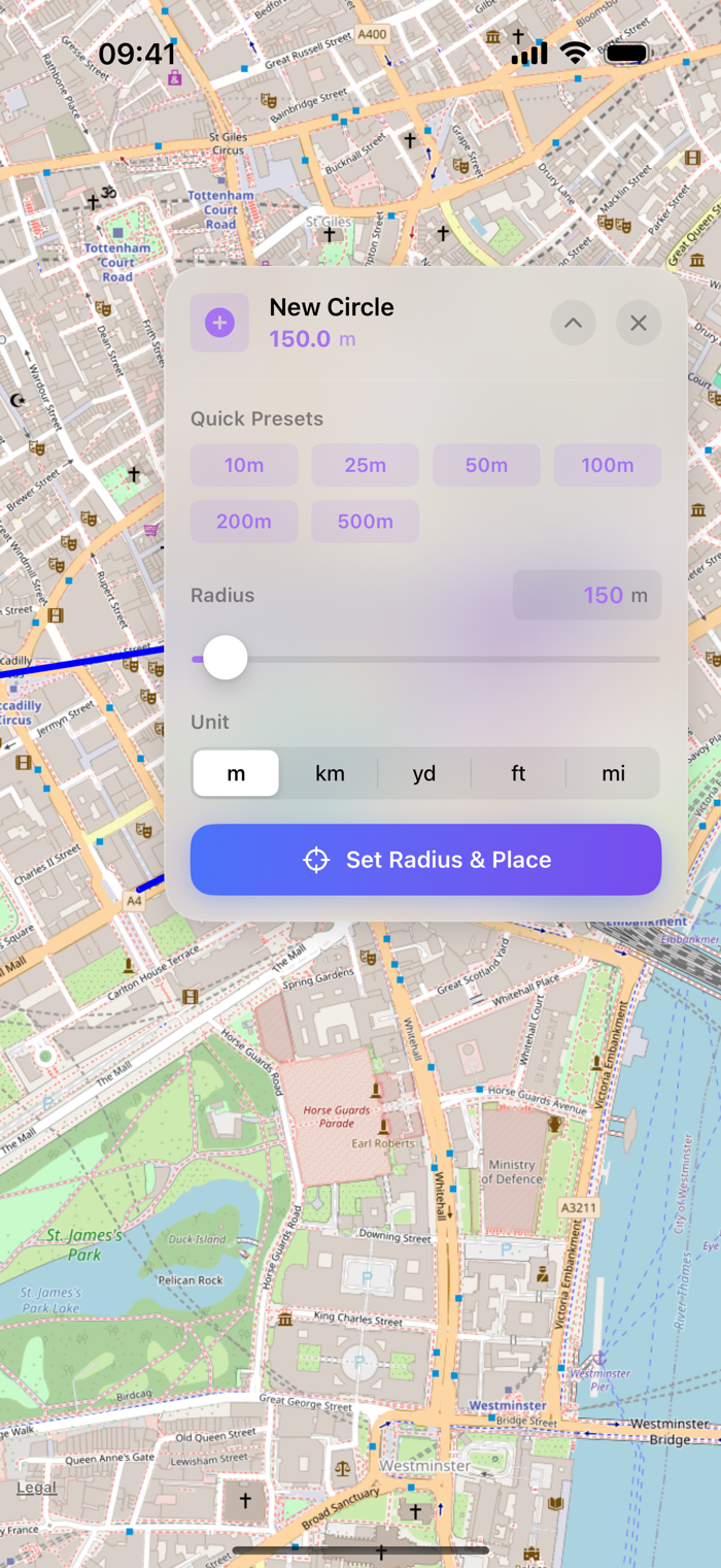
Polygons & Circles: Draw complex polygons and circles directly on the map to define zones, search areas, or perimeters.
Text Annotations: Add custom text labels anywhere on the map with adjustable color and font size.
Full Edit & Move Capability: Easily drag-and-drop any annotation to a new location or use directional controls for fine-tuned precision. Edit all properties after creation.
Professional PDF Reporting:
Generate comprehensive, multi-page PDF reports that serve as professional field documentation.
Automatic Multi-Map Capture: Automatically captures Standard, Satellite, and Hybrid map views at the start and end of your tracking session for a true "before and after" comparison.


 +100宝石


 分享
分享


用户评价
立即分享产品体验
你的真实体验,为其他用户提供宝贵参考
💎 分享获得宝石
【分享体验 · 获得宝石 · 增加抽奖机会】
将你的产品体验分享给更多人,获得更多宝石奖励!
💎 宝石奖励
每当有用户点击你分享的体验链接并点赞"对我有用",你将获得:
🔗 如何分享
复制下方专属链接,分享到社交媒体、群聊或好友:
💡 小贴士
分享时可以添加你的个人推荐语,让更多人了解这款产品的优点!
示例分享文案:
"推荐一款我最近体验过的应用,界面设计很精美,功能也很实用。有兴趣的朋友可以看看我的详细体验评价~"
关注 Mergeek 公众号
领奖遇到问题?联系小门助手