


 App Store


加入 Mergeek 福利群
扫码添加小助手,精彩福利不错过!
若不方便扫码,请在 Mergeek 公众号,回复 群 即可加入
- 精品限免
- 早鸟优惠
- 众测送码
 SailTimer™
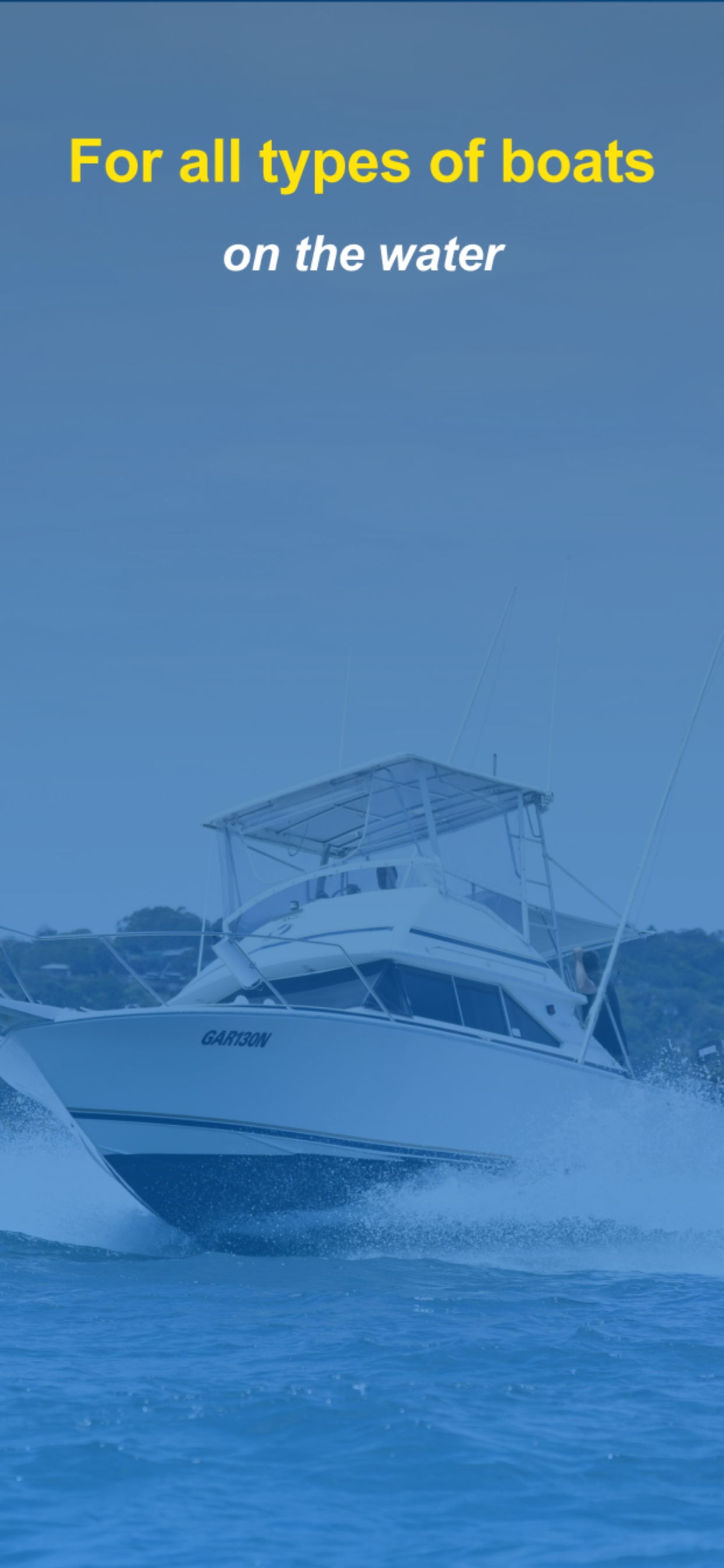
Now for all types of boats. Whether you are going out in a cabin cruiser, sport fisher, sailboat, work boat, kayak or waterski boat, this app shows you an animation of wind and wave conditions before heading out on the water.
There are lots of weather services and apps, but they all use the same satellite weather forecast. Low resolution, low accuracy, and only updated 4 times per day. Weather satellites are 500 to 22,000 miles up in space. Crowdsourcing is changing marine weather. Why rely on satellite imaging, when you can use actual measurements from other boaters? In coastal areas, we archive these to map wind flow for more accuracy.
Crowdsourced weather maps like these have never been possible before. A wind sensor measures local wind around your boat, but now you can also know the wind and sea state up ahead or around the next point.
FEATURES FOR ALL TYPES OF BOATS:
• View your route with free aerial photos and land maps worldwide. If you have the Navionics Boating app, you can import worldwide Navionics charts here with a yearly subscription.
• The crowdsourced wind map animation has a low-cost monthly subscription with a free 7-day trial. Or get the whole year for about half price.
• WNI marine weather is used by thousands of ship captains every day. See maps of waves and swell here, and on-going features that we will be continuing to add. Free 7-day trial.
• Create and rename waypoints by tapping or importing a list. Save, import or email your GPS track.
• Marine charts (raster) based on the paper charts are also available as low-cost in-app purchases for USA, US Virgin Islands, Puerto Rico, large-scale charts of The Bahamas and Cuba, and New Zealand.
• All maps and charts in the app can be used offline.
• The white crosshair icon in the top left is the “Follow-Me” button. If tapped, it turns blue and keeps your location in the center of the screen as you move. Unselect when not moving to look around the map.
• Your device will not go to sleep when the app is open, to allow you to continue to monitor your progress on the chart. You can also continue to track your movement with the app running in the background or when the device is asleep (unless you hard-quit).
(Note: Animation needs more resources than other parts of the weather maps, and may only appear on iOS 16 and later. Continued use of GPS running in the background can dramatically decrease battery life. This app may use your location even when it isn’t open, which can decrease device battery life.)
FOR SAILBOATS:
Whether cruising or racing, it is important to be able to determine the best heading on all points of sail. GPS chartplotters do not calculate tacking distances. But if they do not know the distance you will travel, how can they calculate your correct ETA? This is the only product that calculates your optimal tacks using your tacking distance and polar plots. Details at www.SailTimerApp.com. SailTimer gives you a quick and easy display of your optimal tacks and TTD® (Tacking Time to Destination).
• Use our wireless Wind Instrument or wired Ultrasonic (www.SailTimer.co) to see wind direction, angle & speed. Enter a waypoint and your optimal tacks will update automatically as the wind changes.
• Bring in wind data from any other wind sensor on wifi from NMEA 2000 or 0183, using our low-cost Air Link™ (https://wi-rb.com/airlink).
• Custom polar plots: When using a wind sensor, the app can learn your sailboat's unique speed profile on all points of sail, for the most accurate tacking results.
• Switch the display to the port or starboard tack to avoid obstructions, or let the app automatically display the tack nearest to your current heading.
• Audio Navigation: when using the wireless Wind Instrument, optionally hear wind conditions or boat speed when they change by more than a set amount.
• Convert from Apparent to True wind direction, angle & speed.
See our channel on Tiktok and YouTube Shorts for more background.
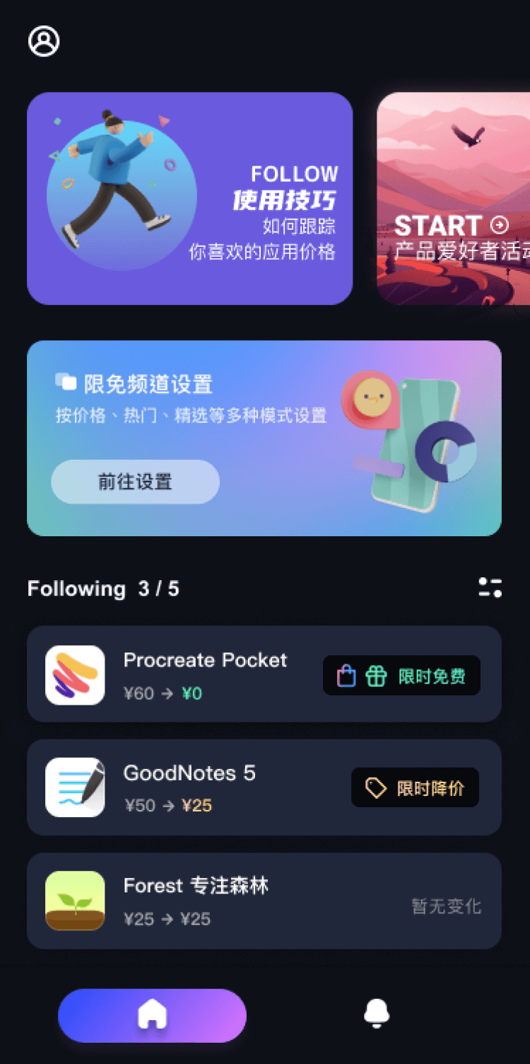
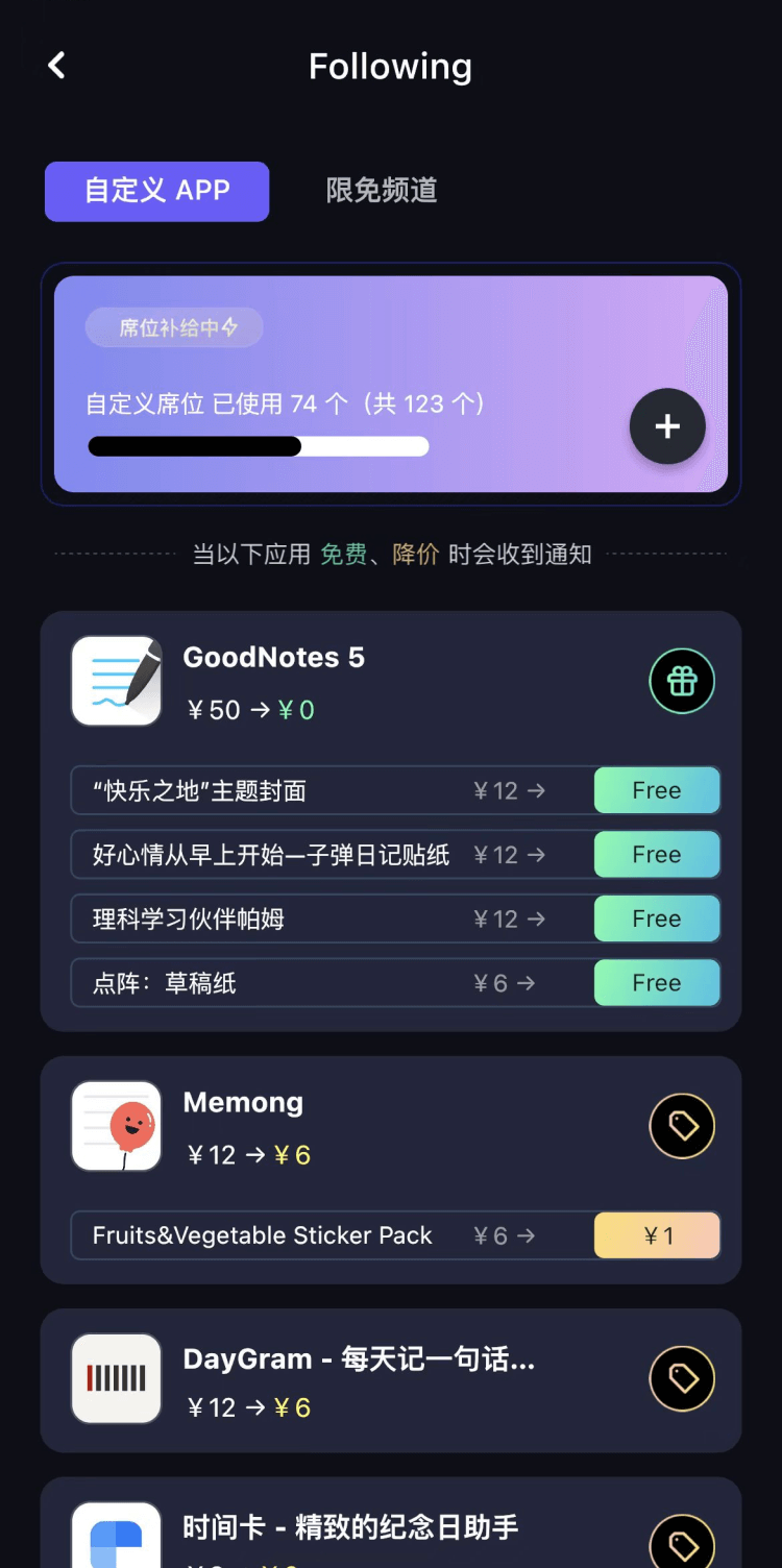
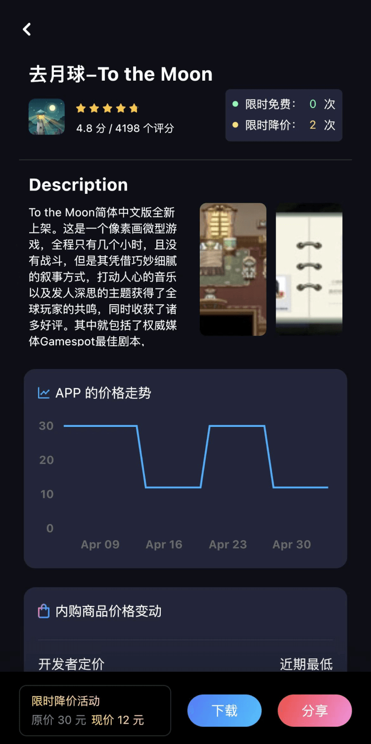
第一时间掌握精选限免应用/游戏信息
自定义喜欢的应用/游戏的价格变动
了解内购应用/游戏的限免或降价活动
查看应用/游戏价格历史等待合适时机再出手
第一时间收到价格通知不错过省钱机会

扫码下载 Follow
 酵母君
酵母君
这款多功能 APP 集成了电子书阅读、音乐播放、互动卡片、漫画阅读、3D 模型预览及个性相册六大核心...

 Mini记账
现在有各种各样的记账工具,有人喜欢简洁的,有人喜欢功能强大的,也有人喜欢设计精美的,这款 APP 是...
 Hi Moss
HiMoss,自主研发的大语言模型与高清虚拟数字人技术,重塑英语口语教学的未来。 我们的 AI 虚拟...
 6
6


这款多功能 APP 集成了电子书阅读、音乐播放、互动卡片、漫画阅读、3D 模型预览及个性相册六大核心...
41

现在有各种各样的记账工具,有人喜欢简洁的,有人喜欢功能强大的,也有人喜欢设计精美的,这款 APP 是...
39

HiMoss,自主研发的大语言模型与高清虚拟数字人技术,重塑英语口语教学的未来。 我们的 AI 虚拟...
天天发现优质应用
 到主屏幕
到主屏幕


产品名
这项是必须填的哦~可用平台
产品链接
这项是必须填的哦~产品一句话介绍
这项是必须填的哦~开发者邮箱
你也可以发送更多的产品故事到 hi@mergeek.com
我们会让你的产品被更多用户看到!
产品名
这项是必须填的哦~可用平台
产品链接
这项是必须填的哦~产品一句话介绍
这项是必须填的哦~开发者邮箱
你也可以发送更多的产品故事到 hi@mergeek.com
我们会让你的产品被更多用户看到!
已经成功发送到你的邮箱了,请注意查收
你成为这个产品的发现者啦,说说你的推荐语吧!